Where does your food come from? Many students across Indiana give the answer “the grocery store.” Although this is often true, the grocery store is not the starting place of our food. Farm Bureau’s Agriculture in the Classroom Program works with kids around Indiana teaching them about the origins of their food and why farmers are important. Through this program, Farm Bureau holds summer workshops for teachers and volunteers giving them ideas about how to teach agriculture in their hometown school systems.
The Allen County Soil and Water Conservation District had the opportunity to participate and lead a couple of sessions in one of the Agriculture in the Classroom workshops on June 1st at Huntington University. Mike Werling, a farmer and part time employee with the Allen County SWCD, lead a workshop on managing erosion. Erosion is a menace that has plagued agriculture for millennia. Werling used the slake test, a homemade rainfall simulator, and a purchased rainfall simulator to demonstrate different ways teachers can educate about soil health and erosion control in their own classroom.
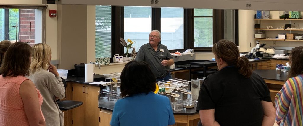
The slake test shows the structural difference between soil in a no-till situation and soil in a tillage situation. It utilizes two class cylinders filled with water. Mesh wiring drapes like a hammock from the top of the cylinders and submerges in the water. For this demonstration, you must have two different dried peds of soil. One ped should be from a no-till field and the other from a tilled field. When the aggregates are submerged into the water and placed on the mesh wiring, the audience can see the difference between the tilled soil and the soil from a no-till field. The no-till ped will hold together, but the soil from the tilled field will break apart easily in the cylinder. Check out this video of a slake test!
The homemade rainfall simulator can be made out of 3 plastic, two-liter bottles with 1/3 of the plastic cut out of the side. One of the bottles should contain nothing but bare soil. The second bottle should be filled with soil, but covered with residue like straw, leaves, or sticks. The third bottle should contain growing cover crops (clover, annual rye, cereal rye, oats, etc). Water is then poured over the two-liter bottles. The bottle with bare soil will lose the largest amount of soil to erosion, the soil with a residue will lose significantly less soil because of the residue, and the cover crop soil will lose the least amount of soil when “rain” is introduced to it. Check out this video of a two-liter bottle simulator!
The purchased rainfall simulator works very similarly to the homemade version. Watch this video to see how a rainfall simulator works!
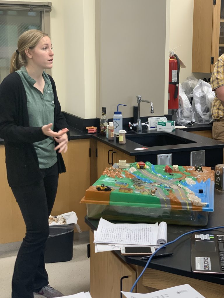
The Allen SWCD also shared a lesson on watersheds and water quality. Joelle Neff used an Enviroscape to teach about how water moves downhill and picks up pollutants in a watershed. Neff also taught a lesson called “Growing with Water” which uses data collected from the Water Quality Initiative Program to discuss why pollutants have varying impacts at different times in the year.
An Enviroscape is a model of a watershed landscape that funnels water into the landscape’s reservoir. The model has a farm, factory, nature preserve, golf course, construction site, neighborhood, water treatment facility, roads, and ditches. Pollutants such as fertilizers, pesticides, human and animal waste, oil, road salt, etc are introduced to the landscape. Simulated rain is then applied to the landscape. Students are able to see all the pollutants that have entered the reservoir after the rain. This tool has fairly easy clean up. You can remove the plug in the reservoir to drain water into the basin below.
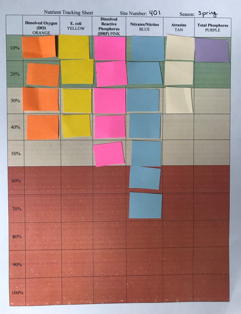
Like mentioned earlier, “Growing with Water” uses data collected from the Fort Wayne Water Quality Initiative Program which has been collecting water samples weekly in Northeast Indiana and Northwest Ohio since 2002. Check with your local Soil and Water Conservation District (SWCD) to see if collect water samples in your area. “Growing with Water” teaches students about the quality of water in their area and the different pollutants that can impact their water systems. Growing with Water shows the variances of water quality in different seasons. Split your class into three different groups: spring, summer, and fall. Have each group come up with a list of what is happening in agriculture and with the weather in their season. Then, provide students a tracking sheet with the percentage of time that the pollutants were higher than they should have been. Have the students work in their groups to make hypotheses about reasoning for the pollutant levels based off what is happening in their season.
If you would like to use any of these demonstrations to teach in your classroom, give the Allen County SWCD a call at 260-484-5848 ext. 3.
