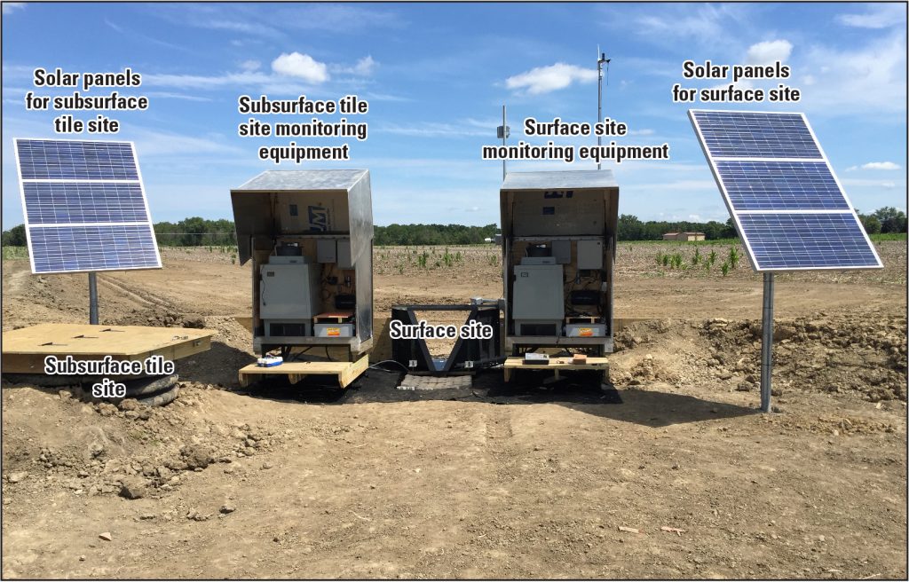
SWCD and USGS partnership: Edge of Field Project. This project collaborates with local farmers to collect water samples for an estimate five years to measure nutrients, sediment, and other critical elements for USGS research. In January 2021, the SWCD staff were trained how to collect samples and send the collection and other information to USGS. Information is collected and sent after significant rain/snow fall events when water has entered the systems. The systems are built on the land of cooperating landowners and farmers, at no cost to the farmer. USGS incurs all of the installation costs and other necessary elements. Click HERE for more information on on the USGS Edge of Field projects.

